
Driver location signs are small blue plates placed roughly every 500 metres along motorways.
They give a precise position reference that emergency services and control rooms can act on immediately.
What this sign means
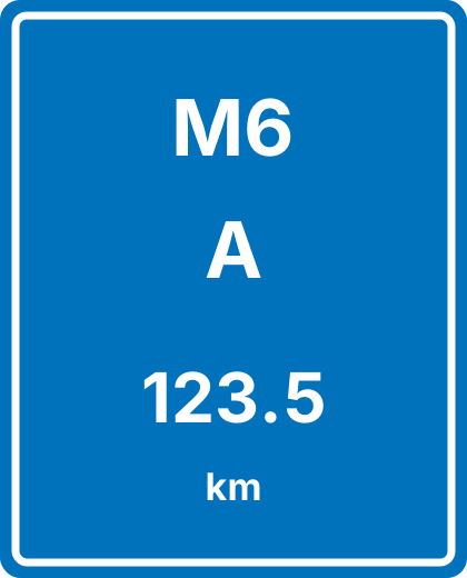
The top line is the road number, the middle letter is the carriageway direction, and the bottom figure is the distance in kilometres from the start of that road.
Carriageway letters such as A and B indicate direction of travel, with J and K used on slip roads.
- Top: road number, for example M6.
- Middle: carriageway letter.
- Bottom: distance marker in kilometres.
What to do when you see it
You do not need to act on it while driving normally.
If you break down, read the nearest one and quote all three lines when you call for assistance.
How this sign is tested
Questions focus on breakdown procedure and knowing how to describe your exact location on a motorway.
Common mistakes
Describing your position by the last junction only, which can be several miles away.
Walking along the carriageway to find a sign instead of staying behind the barrier.
Test yourself on this one
Road and traffic signs is the biggest category in the question bank with 102 questions, and signs turn up inside other categories too. Work through them free, no sign-up needed.
Practise road sign questionsFrequently asked questions
How often do driver location signs appear?
Approximately every 500 metres on motorways.
What does the letter mean?
It identifies the carriageway and direction of travel, which tells responders which side of the road you are on.